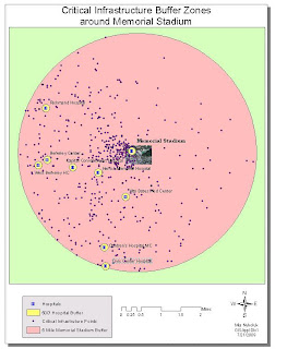


The exercise was to establish surveillance points and identify possible escape routes if there was a terrorist attack at the Memorial Stadium in Berkeley. Ca. In order to accomplish this, a five mile buffer was placed around the stadium and within the buffer a nearby hospital was chosen, Alta Bates Hospital (the closest hospital, was not used as secondary terrorist attack was proposed at the site). Engress and Igress routes were then determined within a 500' radius of Alta Bates Hospital. Back at the stadium, possible surveillance points were established and a Line of Site graph was used to show that one of these points, highlighted in yellow, would not be adequate for viewing the stadium. A #D analysis was used to determine the optimal view points. Unfortunately, on the last project, I could not get the surveillance point that would not be good for viewing the stadium, to show on my 3D project. Other than that I really did not have too many problems with the exception of not keeping such good track of where I put files from week 9. Good lesson for keeping track of things and making sure projections all matched up.
No comments:
Post a Comment