Wednesday, July 22, 2009

Applications in GIS/Homeland Security


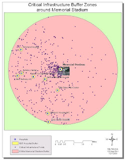
The exercise was to establish surveillance points and identify possible escape routes if there was a terrorist attack at the Memorial Stadium in Berkeley. Ca. In order to accomplish this, a five mile buffer was placed around the stadium and within the buffer a nearby hospital was chosen, Alta Bates Hospital (the closest hospital, was not used as secondary terrorist attack was proposed at the site). Engress and Igress routes were then determined within a 500' radius of Alta Bates Hospital. Back at the stadium, possible surveillance points were established and a Line of Site graph was used to show that one of these points, highlighted in yellow, would not be adequate for viewing the stadium. A #D analysis was used to determine the optimal view points. Unfortunately, on the last project, I could not get the surveillance point that would not be good for viewing the stadium, to show on my 3D project. Other than that I really did not have too many problems with the exception of not keeping such good track of where I put files from week 9. Good lesson for keeping track of things and making sure projections all matched up.

Wednesday, July 15, 2009

Applications in GIS/Homeland Security


Whew-glad this is done! Interesting stuff but hard to know when to start and stop following downloading directions. Took awhile for me to figure out Geonames! HOpe I can find all this for the next project

Wednesday, July 8, 2009

Applications in GIS/Crime analysis


Wish I knew how to make buffers transparent. Also had noticed in side column of graph that not all stations show up. Maybe I should have gotten rid of it altogether. I added census block to each crime layer but looked overwhelming so deleted. I never could get the Effect toolbar to do what it was supposed to but did know census layer was underneath as could put layer on top of crime layer and would show up.

Based on the analysis I would recommend 2 additional locations for police stations in the areas shown because based on overall crimes these areas are hot spots just within the 6 mile buffers. If I could put three more stations in I would include 1 9 miles to the East of the Clear Lake Patrol, 9 miles South of Forden Patrol and 15 miles NE of Clear Lake patrol all of which are towards the outskirts of the city. I would also put more police units out on the night shiftsbased on the time analysis

Wednesday, June 24, 2009

Applications in GIS/Maricopa County


I enjoyed this one for some reason, I think because I can see so many uses for the techniques used in the weighting process. Forgot to Set the data frame properties for the 2nd Weight and had to go back. Also happy to find out again how to make toolbar active as I forgot about Spacial analysis and luckily someone had posted tip.

Applications in GIS/Maricopa County


Didn't think I could get all four layers on one map and VM crashed at one point and nothing saved so had to start all over!

Tuesday, June 16, 2009

Applications in GIS/Urban Planning


I enjoyed working on these deliverables because they introduced me to some new ways tools such as the merge tool. Sometimes I think "wow these are great" but I am not sure I could make these maps without step by step instructions. For example when I add a field I don't think I really understand "text" vs "short integer" vs other options in this area or at least I have an idea but there are still some doubts! Anyway it was a good refresher to use AI. I can say for sure that it takes me at least triple the proposed time ESRI proposes to complete these exercises. I am not quite sure how to figure out the scale on this map so I just noted it was distorted nor am I quite sure if my north arrow is correct?

Applications in GIS/Urban Planning

Wednesday, June 10, 2009

Applications in GIS/Flooding Project


I enjoyed this project although combined with the ESRI homeworkwas very time consuming. I wanted this map to look a little different by having a transparent overlay of the floodwater but unfortunately I could only reduce transparency down to 50% which made the value of property colors washed out so I decided not to do it. I really enjoyed having the template for the layout view.

Tuesday, June 2, 2009

GIS Application/Hurricanes


I just thought this map was pretty cool in that it clearly shows how gradual the elevation change is in southern Mississippi and how huge the watershed basin is. I would do some things a little different if I had time to fix it which would include using my own text to show counties and islands a little clearer. Possibly change the colors slightly as well.

Applications in GIS/Hurricane Katrina Project


I wanted to show this project as I it gives an overall idea as to what land types were affected due to the hurricane and it is easy to understand sq miles. I learned how to create a graph relatively on my own and that each step is vital (ie I forgot to click on the radio button to show only selected features ) there are still some things I do not understand in particular when to float , Text etc. when creating a new attribute in the attributes table. I tried to get rid of the Not Flooded item in the legend but to no avail in fact I ended up loosing the information I had obtained in the floodedlc file and had to go back and redo all that information again! Biggest thing is try to follow directions and not go off and do things that aren't necessary asked for!

Wednesday, May 20, 2009

Testing Blog

Just wanted to see if I changed the time to the right setting.